Gallery


About Project
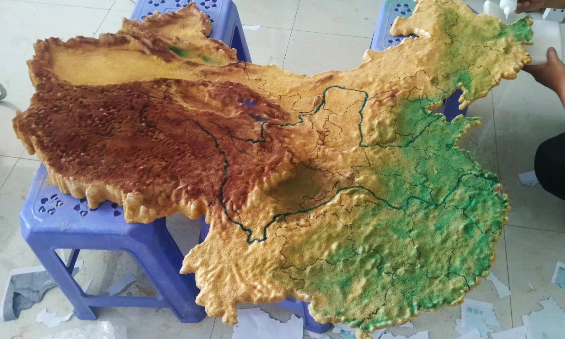
Topographical maps created using 3D printing technologies are durable, portable, and reasonably priced. 3D printed maps can be printed in thousands of colors and texturized. Popular uses include 3D displays of ski runs, marathon routes, hiking trails, underwater terrains, new development areas, underground earth features, geographical features, and much more. Potentially, there are no limitations in the geography, geology, cartography, sports, and residential development planning industries.
In this case, we print the China 3D topographic map as a presentation model for a middle school. The map model is printed with SLA 3D printing method, which is most suitable to produce complicated models. The material involved is SLA Generic Resin SD.
Solution
- Step 1: Get digital elevation data of the map of China. You will typically download that data as a GeoTiff file.
- Step 2: If necessary, crop the section of interest from the larger dataset, then convert that data to a DEM file.
- Step 3: Make a 3D model based on the data and scale it to meet the client’s requirements.
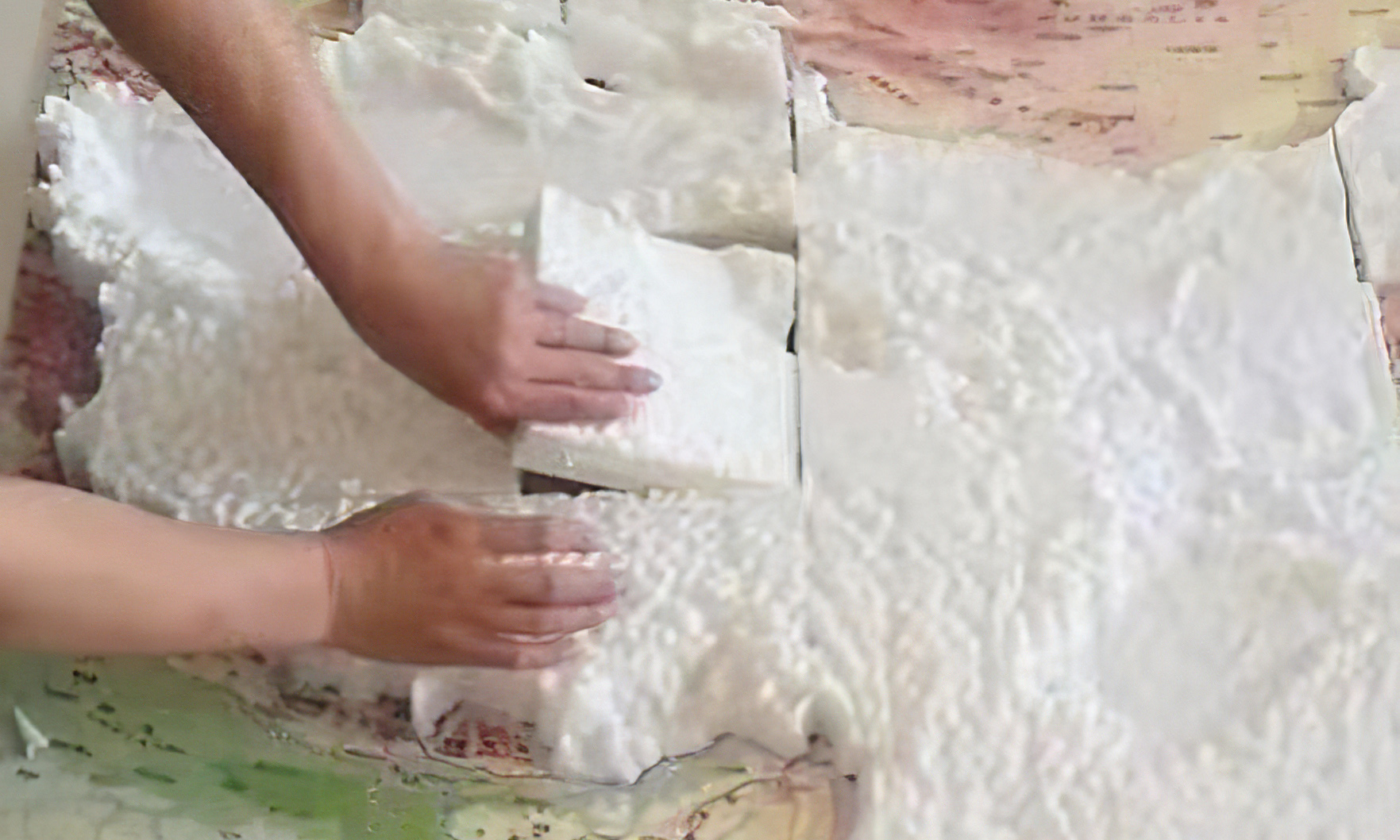
- Step 4: Slice the 3D model and produce different parts with SLA 3D printing technology.
- Step 5: Assemble all the parts and glued them together.
- Step 6: The main post-process of the map model is coloring.
- Step 7: Fix the model onto the base using super glue.


