3D printing maps is a fascinating way to create realistic and detailed models of any place on Earth. Whether you want to make a souvenir of your favorite city, a gift for a geography lover, or a display for your classroom, 3D printing maps can help you achieve your goal.
But how do you 3D print a map? What are the steps and tools involved? In this post, we will guide you through the process of 3D printing maps using some of the best online resources available.
Generate 3D map models with easy-to-use tools
To make a 3D map, the first step is to decide which location you want to 3D print. You can choose any place on Earth, from mountains and valleys to islands and lakes. You can also zoom in or out to adjust the level of detail and scale of your map.
To generate a 3D map of your chosen location, you can use one of the following online tools:
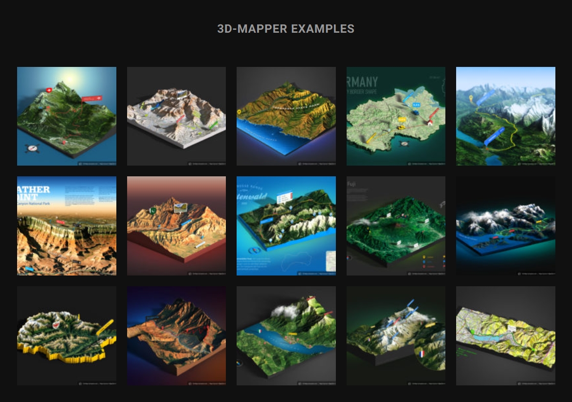
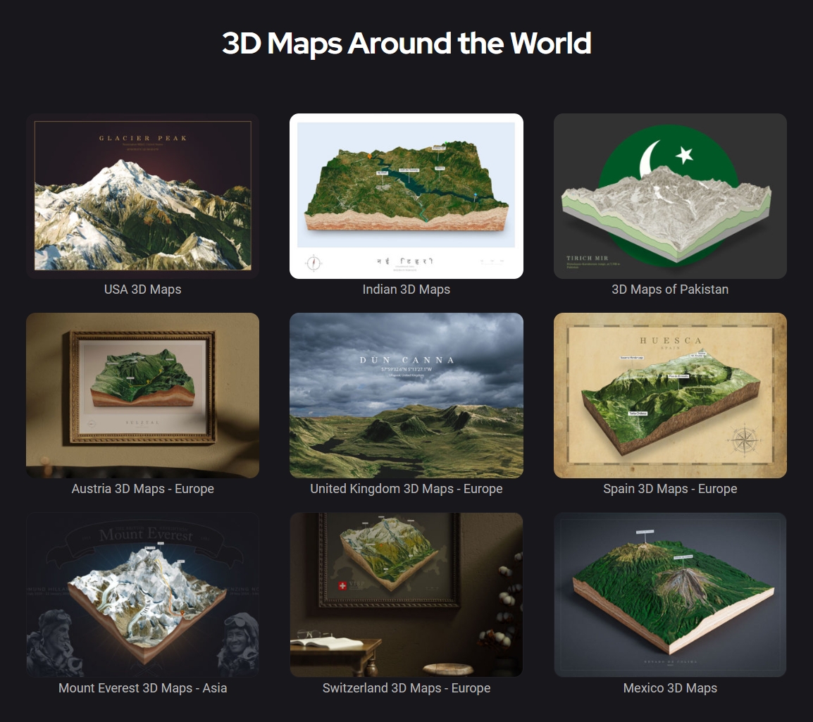
[3D-Mapper]: This tool allows you to create 3D maps of any place on Earth using satellite imagery and elevation data. You can customize the appearance of your map by changing the colors, lighting, shadows, and textures. You can also add labels, markers, and icons to highlight points of interest. Once you are satisfied with your map, you can export it as an STL file for 3D printing.
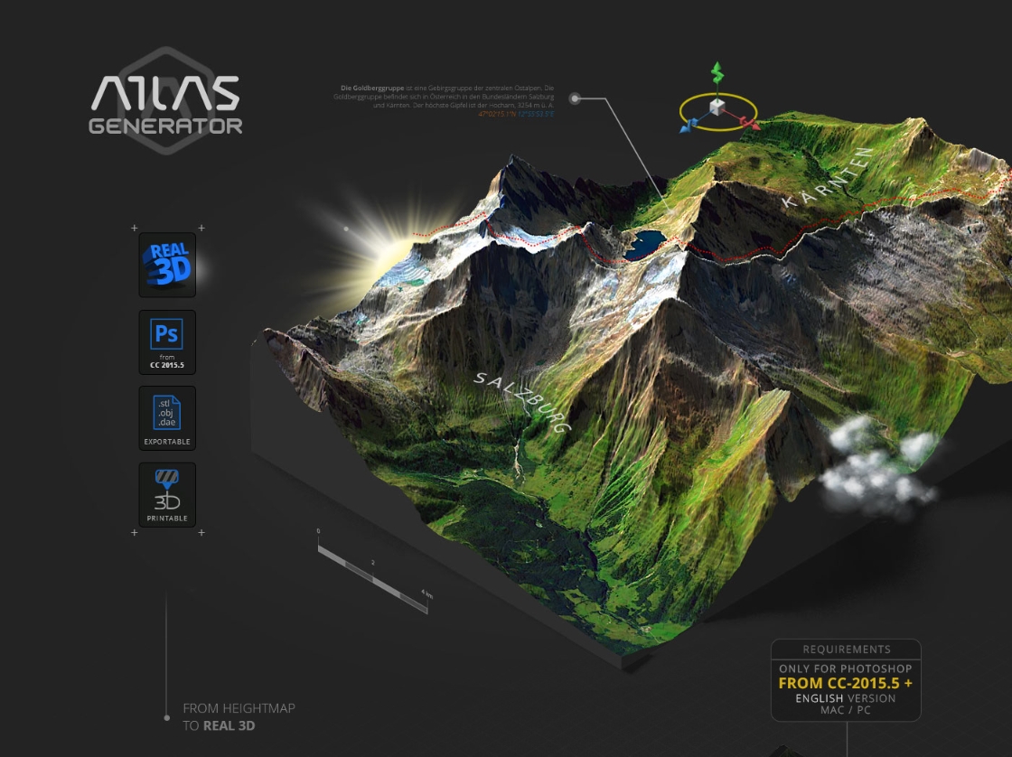
[3D Map Generator]: This tool is a collection of Photoshop plugins that allow you to create different types of 3D maps, such as terrain, isometric, globe, and geo maps. You can use the smart object feature to transform any layer into a 3D map with just one click. You can also adjust the parameters and options to customize your map. You can export your map as an OBJ file for 3D printing.
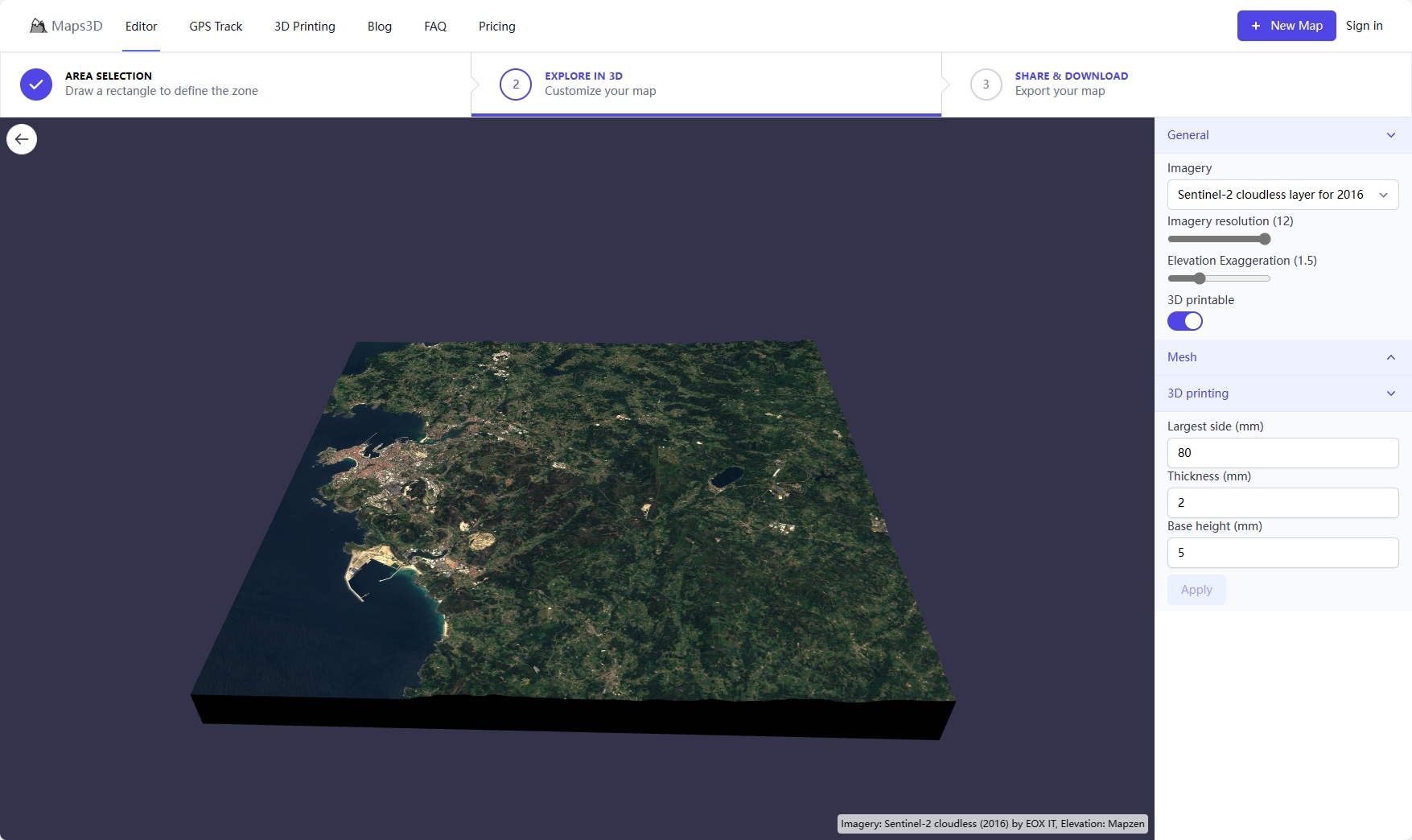
[Maps3d.io]: This tool is a online platform that allows you to generate, edit and optimize your 3D map for printing. You can import your STL or OBJ file and adjust the size, orientation, position, and thickness of your map. You can also use the repair tool to fix any holes, gaps, or inverted faces in your model. You can preview your map in different materials and colors and export it as an STL file for 3D printing.
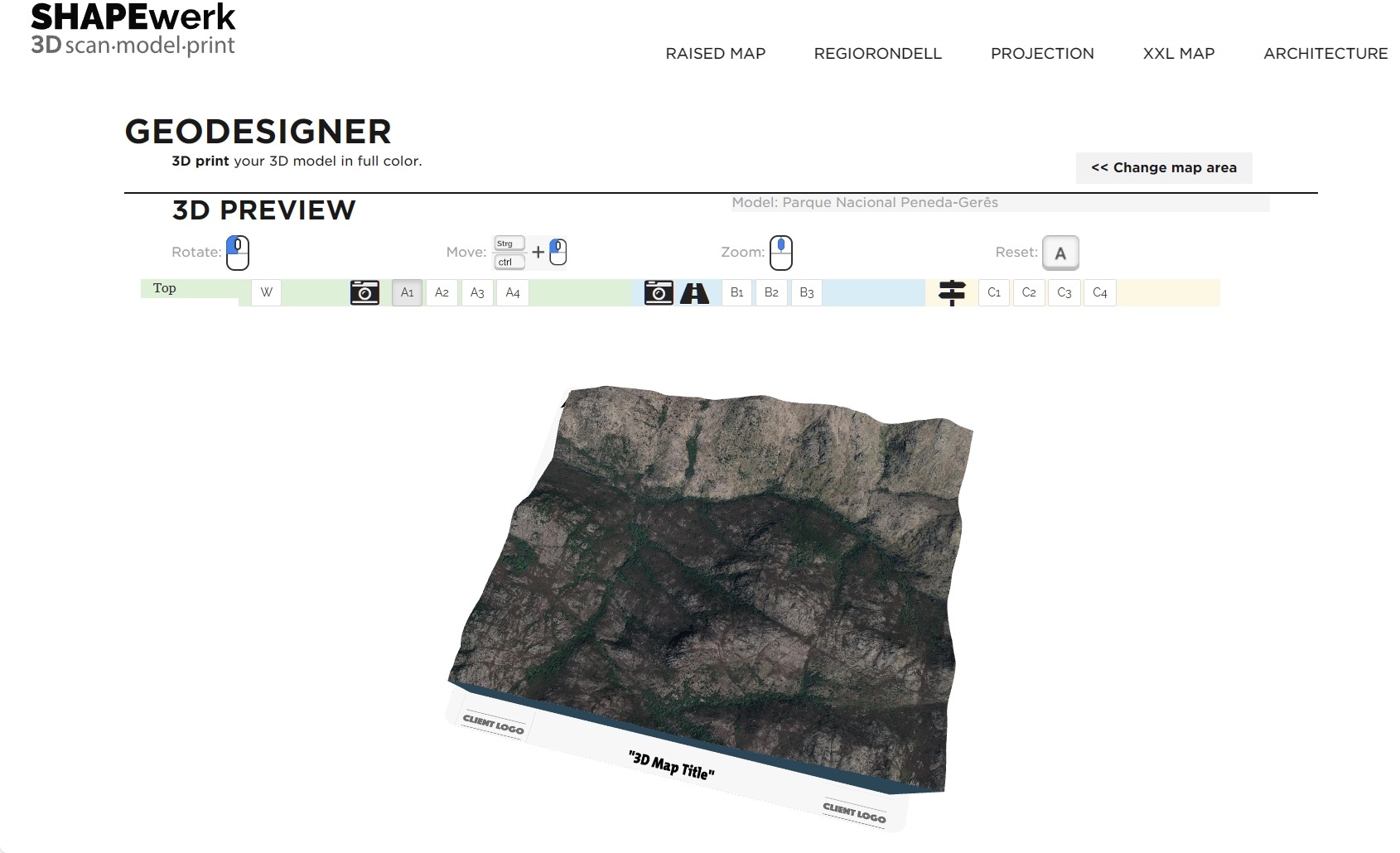
[Shapewerk]: This tool is a web-based service that allows you to order custom-made 3D-printed maps from professional printers. You can upload your STL or OBJ file and choose from various materials, colors, sizes, and finishes for your map. You can also add text or logos to personalize your map. You can preview your map in 3D and place your order online.
Choose the best techniques to make a solid map model
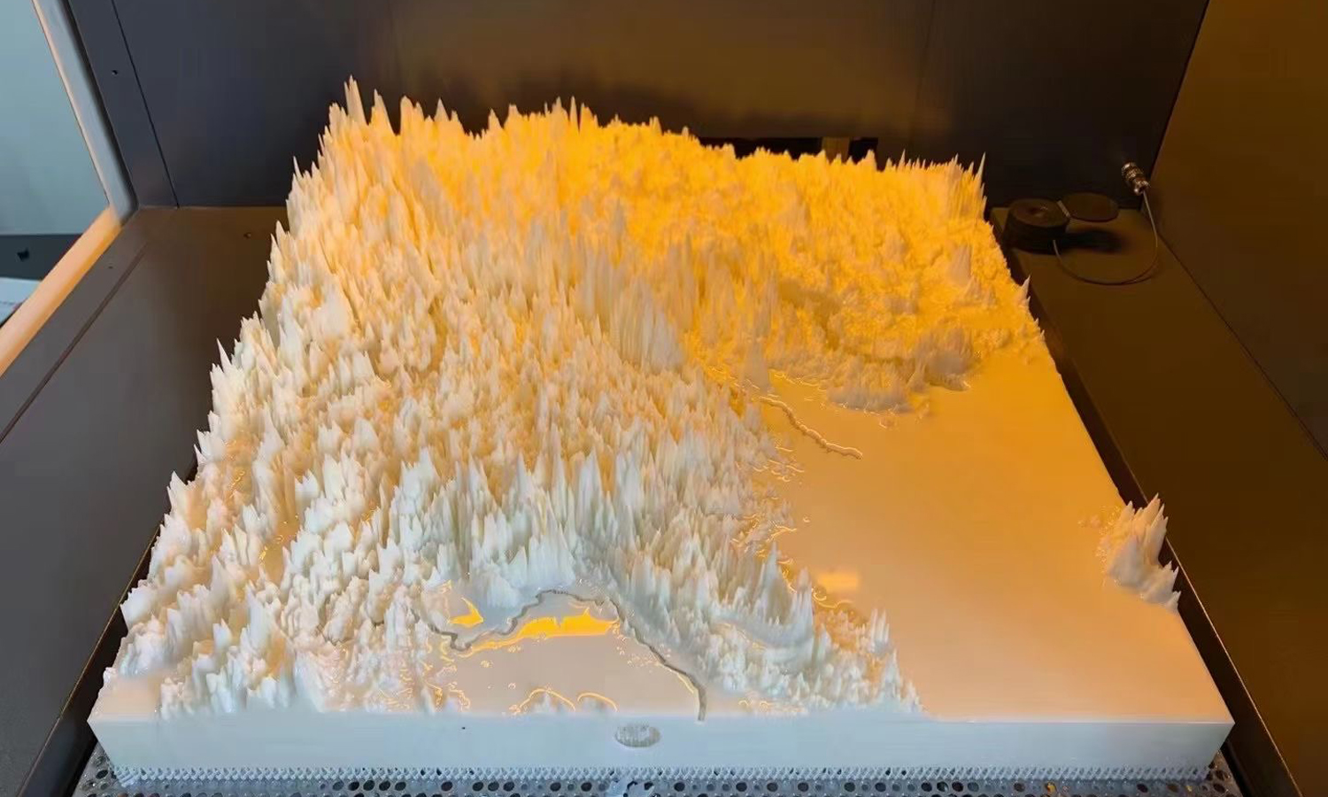
3D printing
This technology uses a machine that deposits layers of material, such as plastic, resin, metal, or ceramic, to create a 3D object from a digital model.
Pros: 3D printing is ideal for creating complex and detailed shapes, as well as customizing the size, color, and texture of the model.
Cons: It can be expensive, and has requirements for the 3D models. As the 3D prints are usually hard, you cannot easily insert a fake tree model into the map.

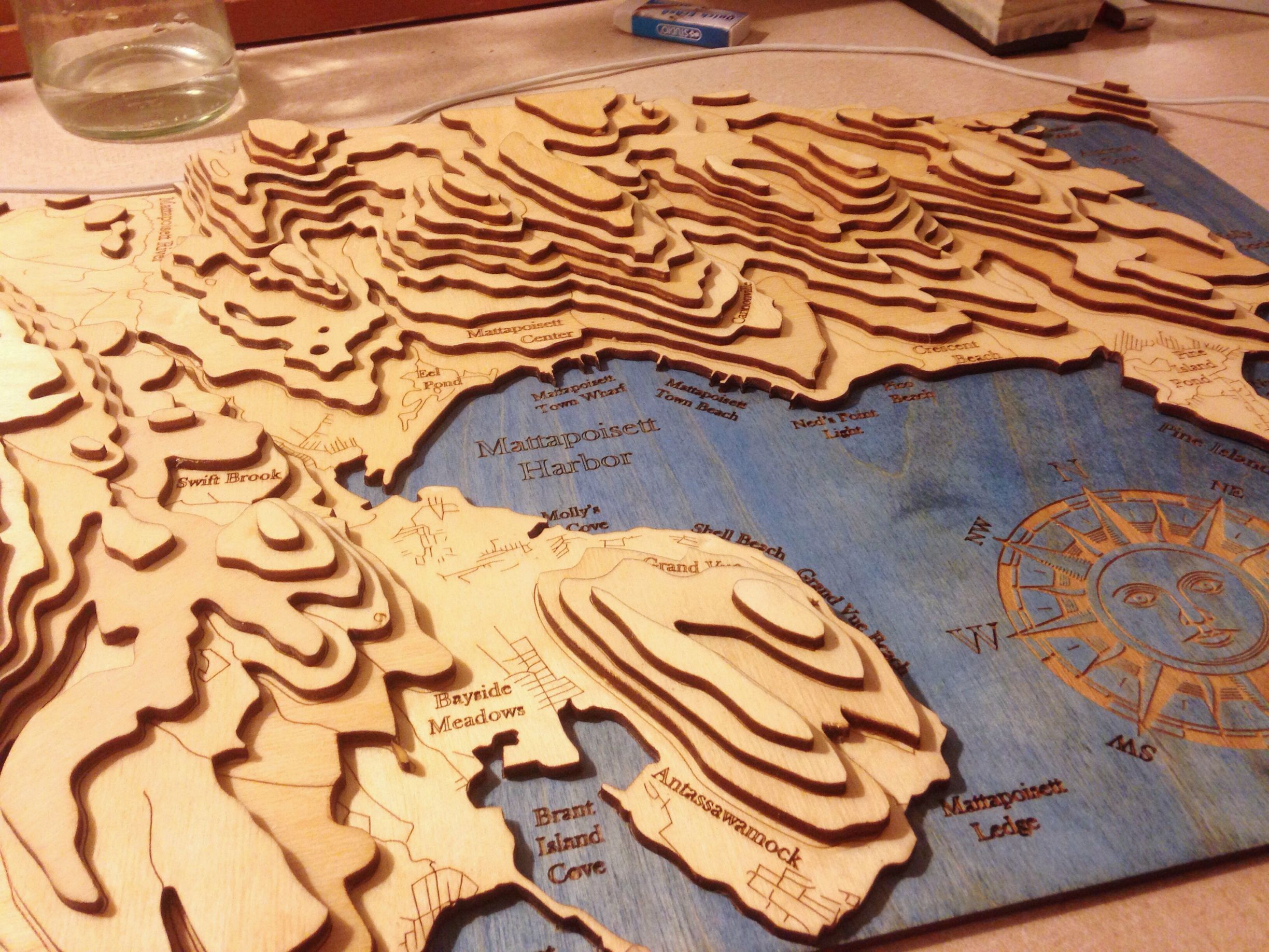
Laser cutting
This technology uses a machine that cuts and engraves flat sheets of material, such as wood, acrylic, or cardboard, into a 3D object based on a digital model.
Pros: Laser cutting is suitable for creating precise and smooth shapes, as well as adding fine details and patterns to the model.
Cons: Some people like the layer-by-layer look, while some people think it abstracts the terrain too much.
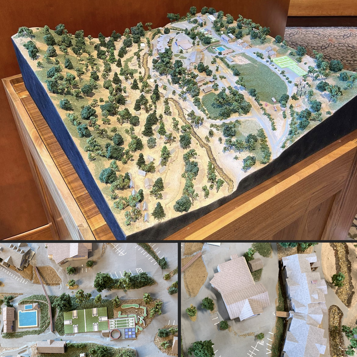
Foam carving
This technology uses a machine that cuts and shapes blocks of foam into a 3D object based on a digital model.
Pros: Foam carving is suitable for creating large and lightweight models, as well as adding surface details and painting the model.
Cons: Carving can be messy and prone to errors and inaccuracies.
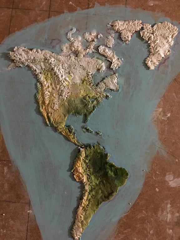
Clay sculpting
This technology uses manual tools and techniques to mold and shape clay into a 3D object based on a reference image or model.
Pros: Clay sculpting is a traditional and artistic way of creating realistic and organic shapes, as well as adding fine details and textures to the model.
Cons: However, clay sculpting can be difficult, tedious, and require a lot of skill and experience.
Decide on which material is better for 3D printing map
The final step is to print your 3D map using a suitable printer and material. Depending on the size and complexity of your map, this might take from a few hours to several days. You can use one of the following options to print your 3D map:
Use your own printer: If you have access to a 3D printer, you can print your map yourself using the STL file you exported from the previous step. You will need to choose a material that matches the desired look and feel of your map, such as PLA, ABS, resin, or wood. You will also need to set up the printer settings such as temperature, speed, layer height, and infill according to the specifications of your printer and material.
Use an online service: If you don’t have access to a 3D printer, you can use an online service that offers 3D printing on demand. You can upload your STL file to facfox.com and choose from various printers, materials, colors, and finishes for your map. You will receive a quote for the cost and delivery time of your print and pay online. We will print your map and ship it to you.
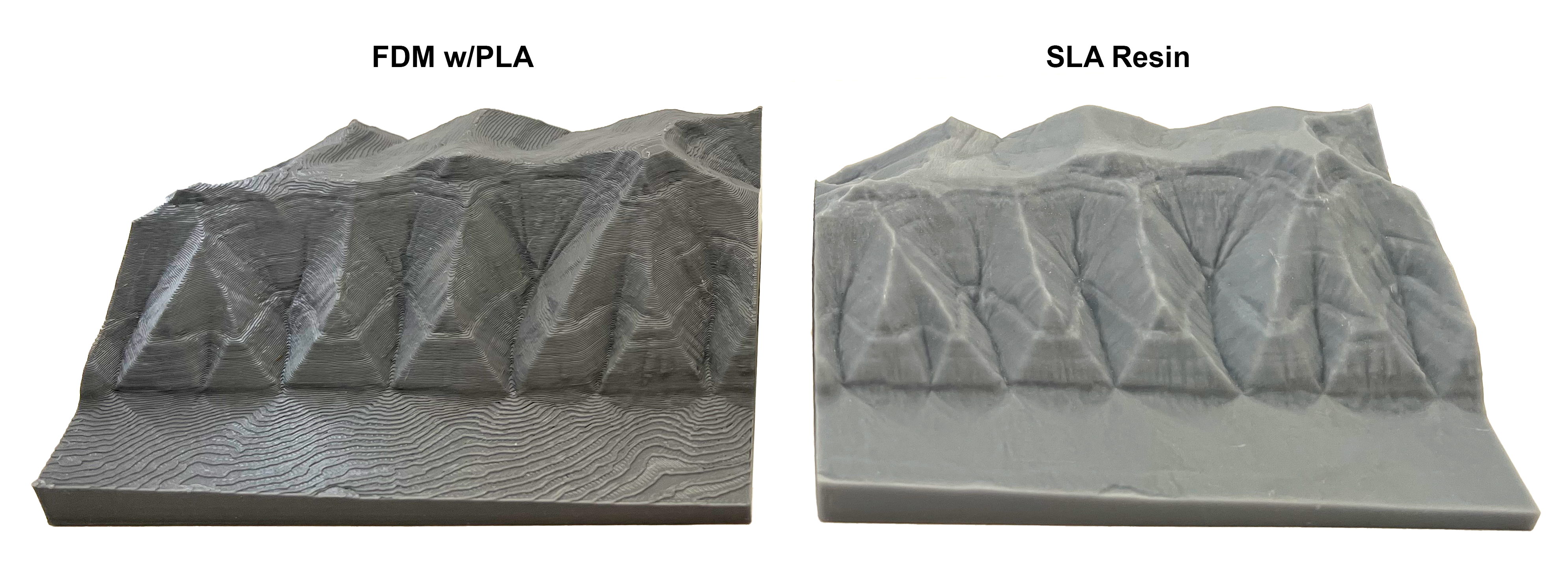
As for a simple-color 3D map scaled-down model, you can directly print it with a desktop FDM 3D printer or an SLA resin 3D printer. The difference lies in surface finishing. FDM 3D printed map would have obvious layer lines, and no matter sanding or not, the precision is inferior to resin ones. But FDM allows you to use multifilaments, which could give the 3D map relatively abundant colors.
As for full-color 3D map, we would definitely recommend Color Jet sandstone. It has vibrant colors and a cost-effective price, which also supports large-size 3D printing. With the minimum layer height of 0.1mm, the technology could print the characters, railways, smaller waterways, or other prominent non-road objects quite clearly directly on the map.
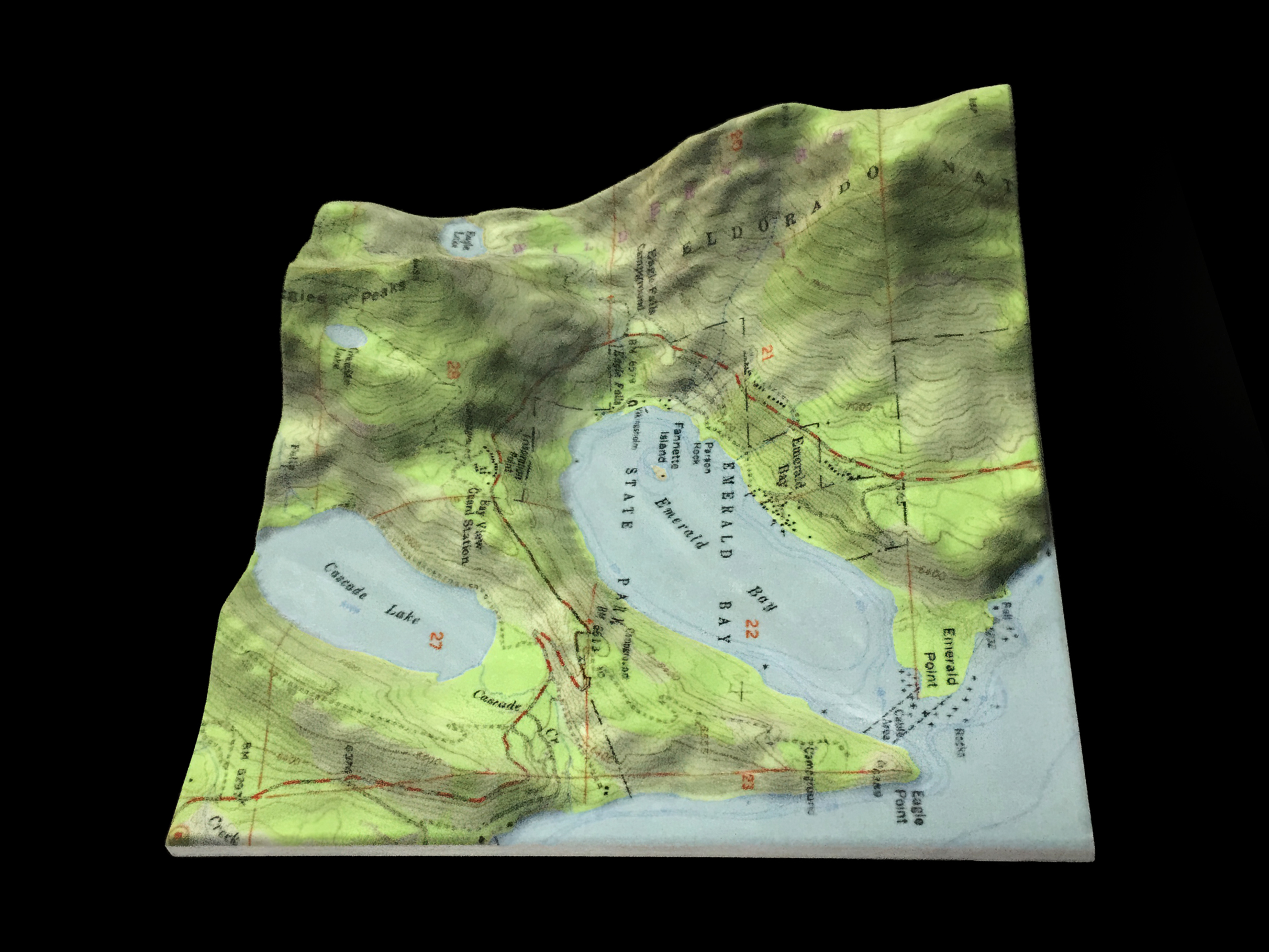
3D print full-color sandstone map. photo source: FacFox
Conclusion
3D printing maps is a fun and creative way to bring any place on Earth to life. You can use online tools to generate, edit, and optimize your 3D map and print it using your own printer or an online service. You can make 3D maps for yourself or as gifts for your friends and family. You can also use 3D maps for educational or artistic purposes.
We hope this post has inspired you to try 3D printing maps and explore the world in a new dimension. If you have any questions or comments, please let us know in the section below. Feel free to contact us via info@facfox.com. Happy 3D printing!